How Satellite Monitoring Measures Carbon in Coffee Farms
Satellite remote sensing combined with bespoke allometric equations enables farm-level carbon measurement across 250,000+ coffee farms. Here's how it works.
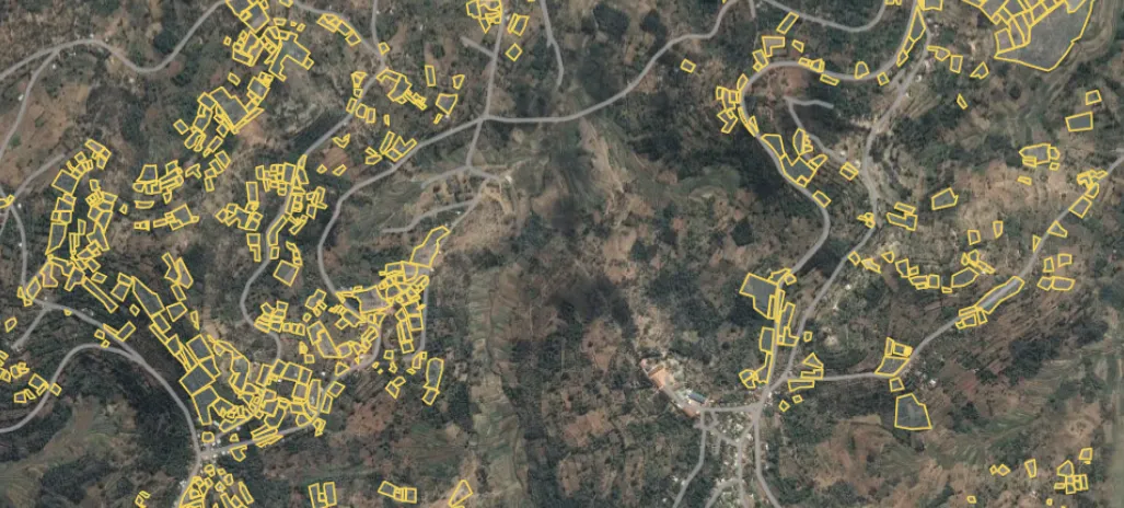
Measuring carbon across 250,000+ smallholder coffee farms isn’t something you can do with clipboards and field visits alone. F.O.C.U.S.™ uses satellite remote sensing to track biomass changes across mapped farms — but the real innovation is in how that data is converted into carbon estimates.
The allometric equation gap
Allometric equations are mathematical models that convert physical tree measurements — size, diameter, canopy structure — into carbon estimates. Forestry has had these for decades, calibrated for timber species in temperate and tropical forests.
Coffee had nothing. No one had done the research on carbon storage in subtropical tree stocks like coffee. Without coffee-specific equations, the only option was to use generic forestry models — which don’t account for coffee’s unique growth patterns, intercropping systems, or canopy structure.
The result: carbon estimates for coffee farms could vary by a factor of 3.5×.
Building equations from scratch
F.O.C.U.S.™ solved this by sampling and measuring large numbers of coffee trees directly — recording diameter at breast height (DBH), canopy dimensions, and growth patterns across different regions, altitudes, and farming systems.
From this data, bespoke allometric equations were developed specifically for coffee agroforestry. These account for:
- Coffee tree size, diameter, and growth stage
- Shade tree species and canopy structure
- Intercropping patterns (banana, legumes)
- Regional climate and altitude variations
How satellite monitoring works in practice
High-resolution multispectral satellite imagery — at 1.5m resolution — provides data on vegetation density, canopy cover, and growth patterns across all mapped farms.
The bespoke allometric equations convert this satellite data into above-ground carbon estimates. Historical imagery also verifies that no deforestation or land conversion has occurred in the prior four years, supporting additionality and leakage prevention.
The full picture: above and below ground
Satellite monitoring handles above-ground carbon. Below-ground soil organic carbon is measured separately using Loss on Ignition testing with stratified sampling at 30cm depth. The two are combined for a complete carbon account — verified, traceable, and linked to individual farms.
This dual approach is what makes F.O.C.U.S.™ measurement credible enough to issue verified carbon credits backed by real data, not estimates.
For the full technical detail, see our carbon measurement methodology. For a visual overview, visit Our Tech.